
AHP Precision Mapping and Data · A division of AHP Servicing LLC
As-Built Maps You Can Build From
Drawings drift from what actually gets built. We fly your site with an RTK survey drone and deliver a measured, to-scale as-built record of what is really there, so your team builds, verifies, and closes out from the truth on the ground.
RTK positioning accurate to centimeters, not feet. Every map measures true, and repeat visits line up from the exact same positions.
What the deliverable looks like
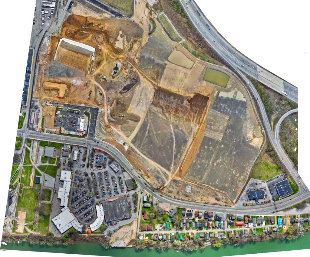
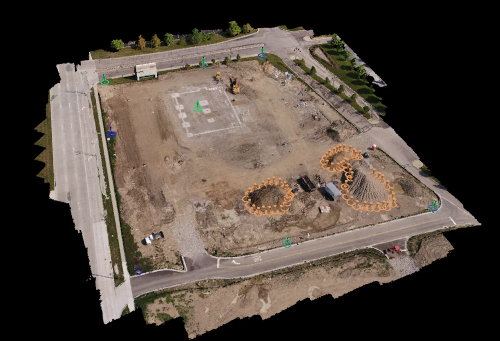
This is a full-site orthomosaic produced from an AHP RTK mapping flight: one to-scale image of the whole site that your team can measure from directly.
The problem we solve
Plans change in the field. Utilities move, footprints shift, grades come in different than the drawings. When the as-built record is wrong or missing, it surfaces at the worst time: at inspection, at closeout, at the lender's desk, or on the next phase of work. A measured aerial record settles what was built, where, and to what dimensions, with a dated document everyone on the project can share.
More than pictures
Most drone companies hand you photographs. AHP Precision Mapping and Data delivers measurements. The same RTK flights that produce your as-built can also document construction progress on a monthly, bi-weekly, or weekly schedule from the exact same positions every visit, and our thermal camera can scan the building envelope and roof for heat loss and moisture problems in the same mobilization.
Your first as-built map is free.
One site, one flight, one finished as-built map, on us. See the product before you spend a dollar. One-time site maps and as-builts start at $400 after the first one.
Start with the free as-builtHow it works
We fly
Our FAA Part 107 pilot flies your site with an RTK-equipped drone and ground control, capturing high-resolution imagery accurate to centimeters, not feet.
We process
The imagery is processed into a to-scale orthomosaic map and a measured as-built plan of the site as it stands today.
You build from it
You receive the finished map files and a shareable project page your owners, lenders, engineers, and inspectors can open from any phone.
What you receive
- High-resolution orthomosaic map of the full site, to scale
- Measured as-built plan: building footprints, rooflines, paving, and site features
- Distances and areas measured from the map for verification against plan
- Dated aerial photo set from fixed, repeatable positions
- A permanent project archive, organized by date, for closeout, insurance, and future phases
Construction progress documentation, priced per visit
Recurring documentation for the life of the build, flown from the same positions every visit. Pricing covers sites up to about 5 acres, with Kansas City metro travel included. The price is locked for the length of the build, weather reschedules are free, and standard delivery is 48 hours.
| Program | What each visit includes | Monthly | Bi-weekly | Weekly |
|---|---|---|---|---|
| Documentation | Repeatable photo set, edited progress video, project page, dated archive | $325 | $295 | $265 |
| Mapping | Everything in Documentation, plus an orthomosaic map every visit and a thermal photo set | $595 | $545 | $495 |
A single progress visit with no commitment is $395. Add-ons on any visit: a thermal inspection report from $250, a ground-level photo set for $125, and rush 24-hour delivery for $100. Mileage past 30 miles is billed at $0.72 a mile beyond 30.
Why builders choose AHP
- RTK precision on every flight, so maps measure true and repeat visits line up
- FAA Part 107 certified and insured, with $1M in liability coverage, raised on request
- One local Kansas City vendor for as-builts, progress documentation, mapping, and thermal
- Professional reports and records your whole project team can use